February 2026
The Sky Tonight - February 2026
February continues the appalling season of summer and appropriately brings us into Bunuru – ‘the second summer’. On the …
ExploreOctober brings us into the season of Kambarang, and with it, a noticeable increase in warmer weather. The clear skies present great opportunities for stargazing. The Milky Way is in the western sky during October evenings, marked by Scorpius and the bright red Antares at its heart.
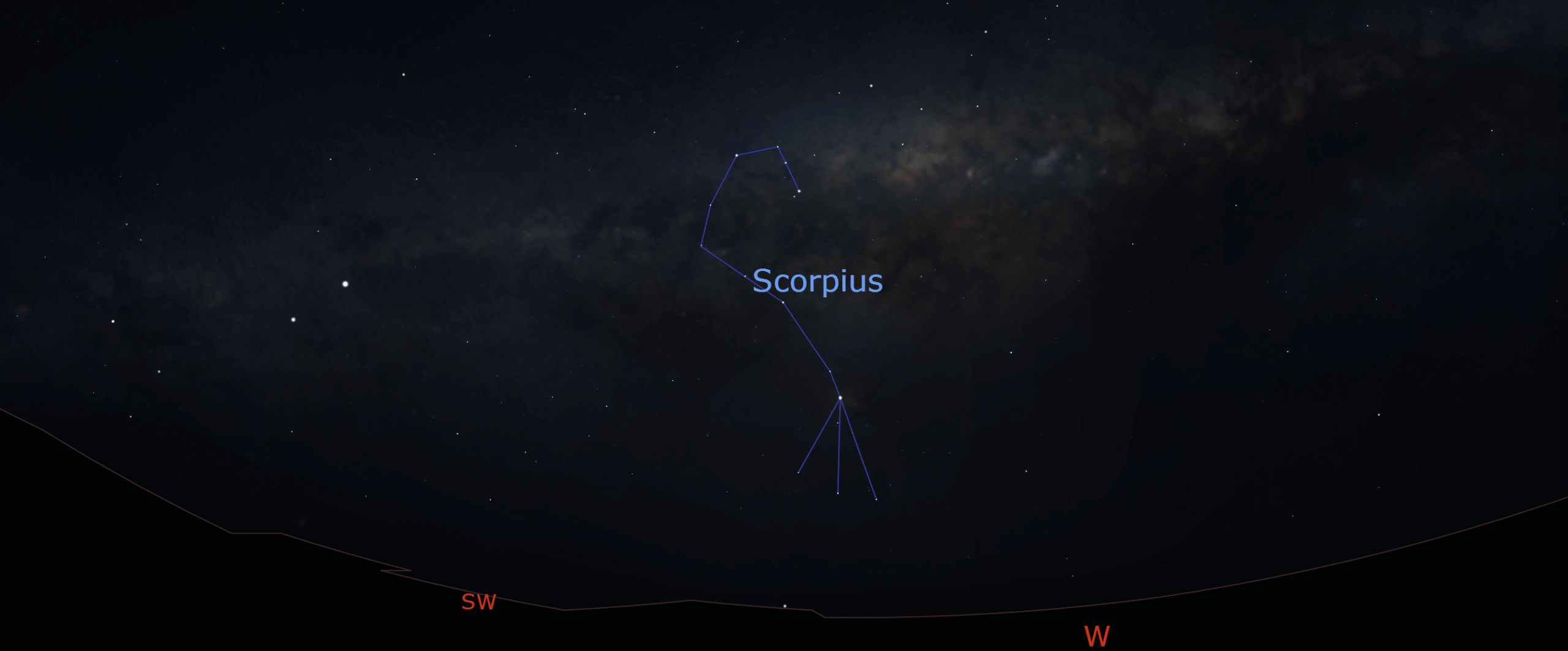
Image: The Milky Way and Scorpius are in the western sky during October. Credit: Stellarium.
Mercury makes for good observing during the second half of the month as it reaches its maximum separation from the Sun in the sky. You can see it on the western horizon after sunset, alongside the faint Mars. On October 20 the two planets reach their closest, separated by about 2 degrees. Mercury will be brighter magnitude –0.19 and Mars is faint magnitude 1.45. They are joined by the New Moon on October 23.
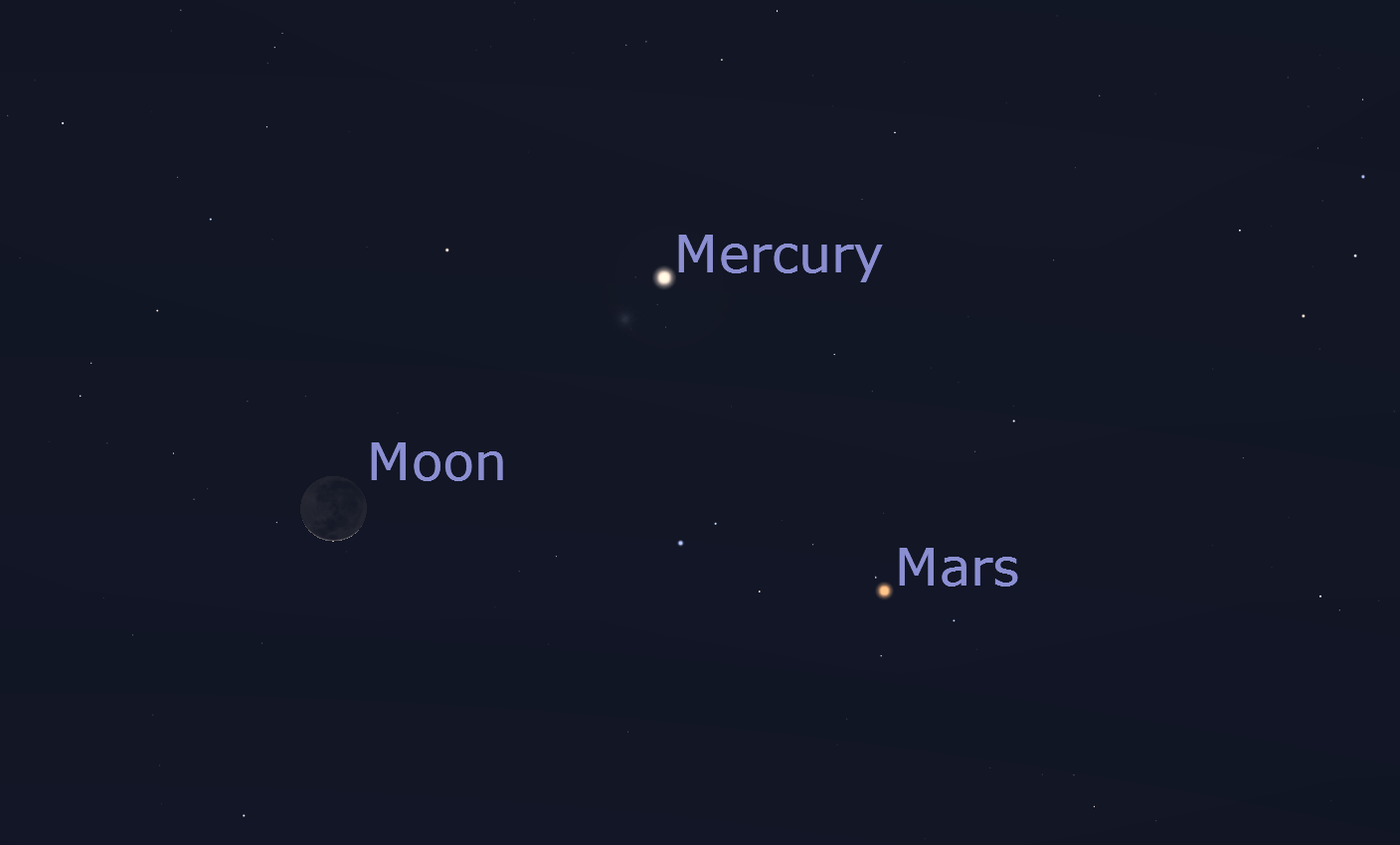
Image: Mercury, Mars and the Moon are close together in the western sky on October 23. Credit: Stellarium
The Orionids meteor shower peaks on October 21. The constellation doesn’t rise until around midnight so the best time to see this shower is in the early hours of the morning in the northeastern sky.
Meteors in this shower actually originate from Halley’s comet. Tiny specks of dust that were ejected from the comet centuries ago briefly light up the sky with streaks as they are swept up by Earth, a bit like the proverbial fly on the windscreen. In good conditions you might expect to see a meteor every few minutes.
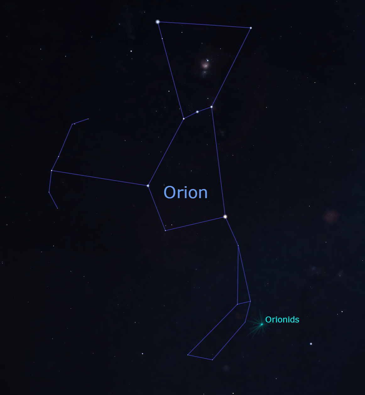
Image: Apparent location of Orionids meteor shower. Credit: Stellarium.
The International Space Station passes overhead multiple times a day. Most of these passes are too faint to see but a couple of notable sightings* are:
| Date, time | Appears | Max Height | Disappears | Magnitude | Duration |
| 6 Oct 04:48 AM | 10° above SW | 48° | 10° above ENE | -3.0 | 6 min |
| 8 Oct 7:47 PM | 10° above NNW | 50° | 50° above N | -3.4 | 2.5 min |
Table: Times and dates to spot the ISS from Perth
Source: Heavens above, Spot the Station
*Note: These predictions are only accurate a few days in advance. Check the sources linked for more precise predictions on the day of your observations.
Mercury and Mars closest approach
November 20
Orionids Meteor Shower peaks
October 21
Mercury, Mars and Moon together in western sky
October 23
Mercury makes for good observing in the western sky during October evenings. The faint Mars is there as well, though this is not a great time to see it.
Saturn is visible in the eastern sky after sunset and ambles across the sky over the course of the night. Jupiter is rising at about 2am so is best viewed in the northeastern sky before sunrise.
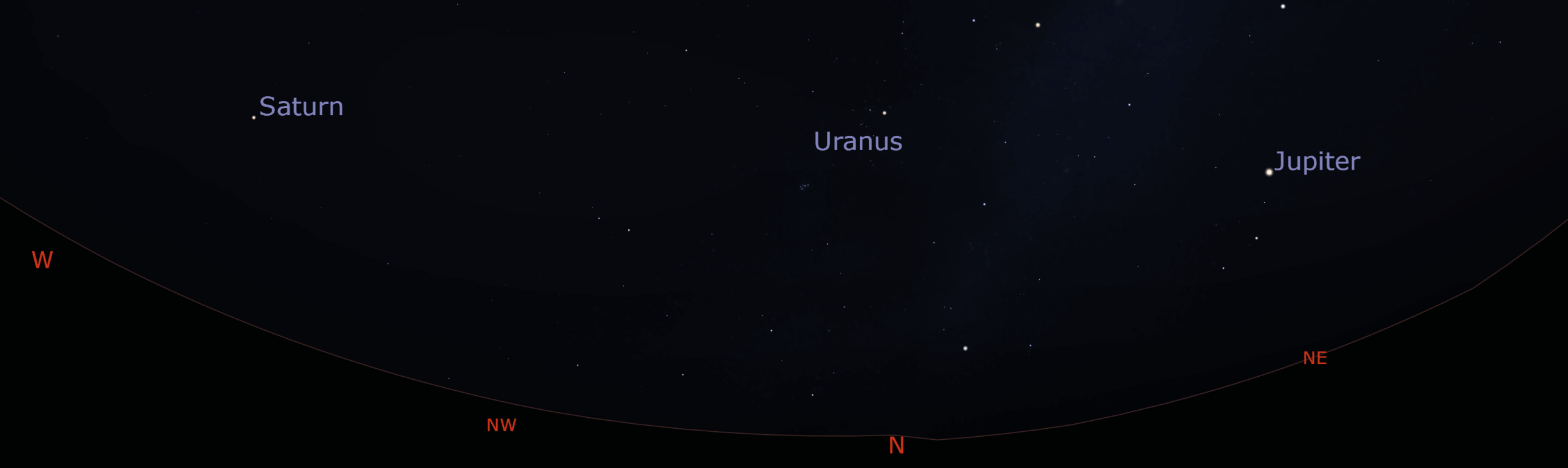
Image: Location of Jupiter and Saturn before sunrise during October. Uranus is visible as well, with a telescope. Credit: Stellarium
Venus is not really worth looking at this month, low on the eastern horizon before sunrise. In the coming months it will disappear behind the Sun until about February where it will appear in the night sky.
Triangulum Australe is a small constellation edging on the Milky Way in the far southern sky. Its three brightest stars, Alpha, Beta and Gamma TrA form a nearly equilateral triangle standing out from the background stars.

Image: Triangulum Australe is about as literal as they get. Credit: Stellarium
Being so far south, the constellation is circumpolar, meaning that it never goes below the horizon as seen from Perth so is visible all night, every night of the year. During October evenings you can find it in the south-southwest, just above the pointers.
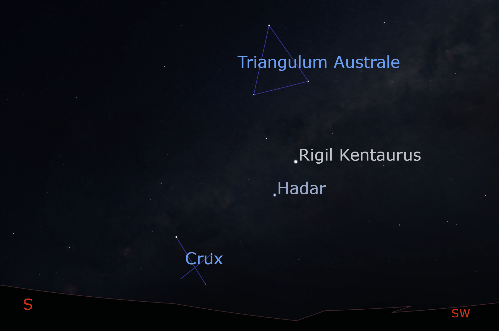
Image: Location of Trianuglum Australe in the sky. Credit: Stellarium
Despite bordering the band of the Milky Way, there are relatively few bright objects or deep sky targets inside the constellation. Perhaps it is best to sit back and enjoy the shape for what it is.
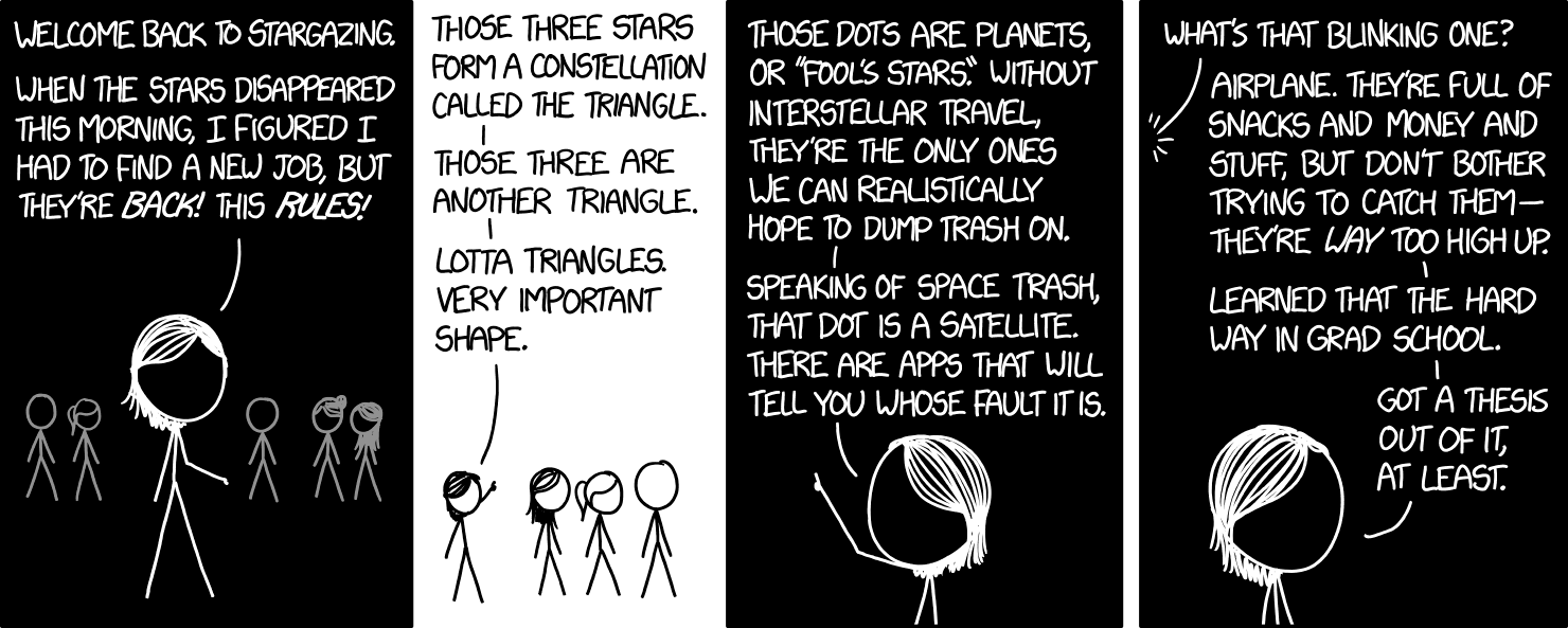
Image: Very important shape. Credit: xkcd
Mercury is in the best location this year to see it, as its maximum separation from the Sun as viewed from Earth means it will be visible a bit later than usual after sunset, especially towards the end of October. If you’re looking around October 22/23 you might catch sight of the background globular cluster NGC 5897 as well.
Image: Apparent locations of Mercury and NGC 5897 (top) on October 22. Credit: Stellarium
On July 30 a magnitude 8.8 earthquake off Russia’s Kamchatka Peninsula triggered a tsunami that spread across the Pacific Ocean. In addition to warnings from seismic centres and deep ocean pressure sensors, scientists had an early warning from a surprising place: the upper atmosphere.
The story takes another twist when it turns out it all has to do with how GPS (Global Positioning System) error correction is implemented. GPS works by measuring how long it takes for a signal to travel between a receiver, say your phone, to several GPS satellites in space. These signals travel at the speed of light, and since the speed of light is constant, once the time is measured your receiver can work out how far away the satellites are. Once your phone knows how far away you are from several GPS satellites, it can work out where it is. This process is called trilateration.
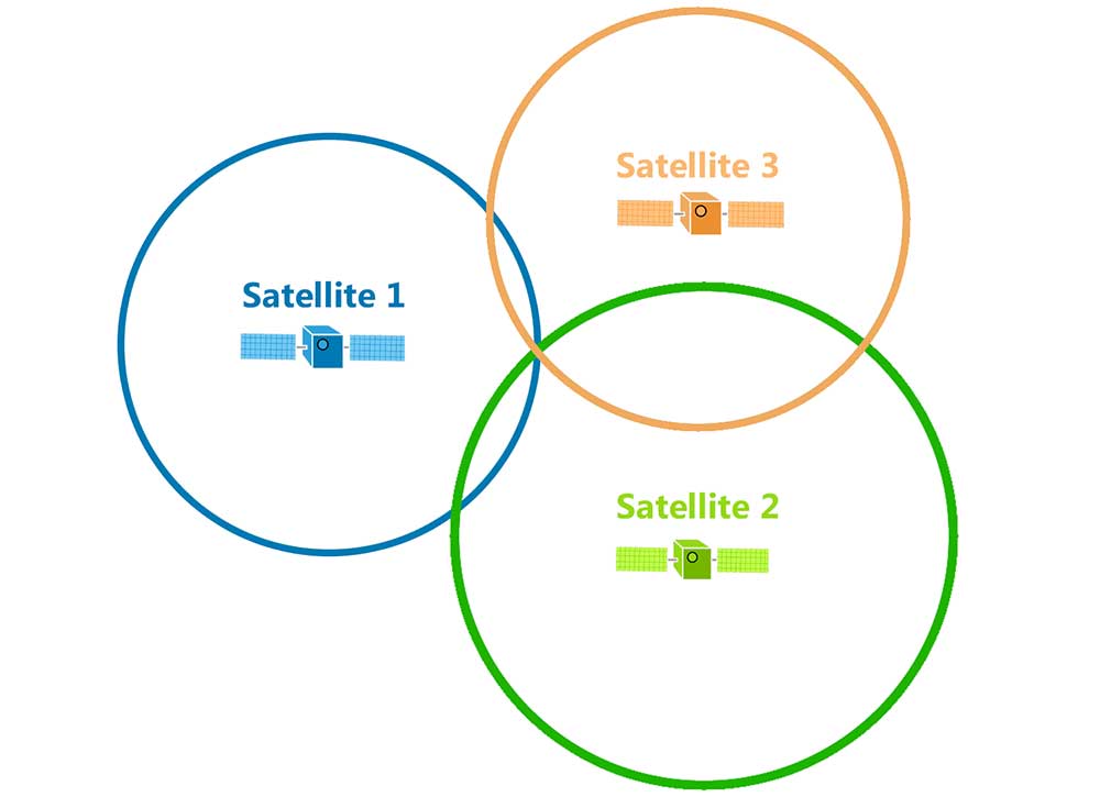
Image: Visual representation of how trilateration works. There is only one place where you can be at those distances from all three satellites. Credit: GIS Geography
A kink in the machine is that GPS signals are affected by the upper atmosphere – the ionosphere. The ionosphere contains many free electrons moving around as a plasma. Radio signals between GPS receivers on the ground and satellites in space interact with the free electrons, which slows them down, making them take longer to travel to your phone. Since light travels so fast, a delay of even a few milliseconds can add up to an error of many metres in accuracy. For this reason, GPS operators spend a lot of effort studying the ionosphere and monitoring its activity, ultimately trying to estimate the Total Electron Count. Once you can estimate this value, your GPS receiver can subtract off the delay to correct for errors introduced by the ionosphere.
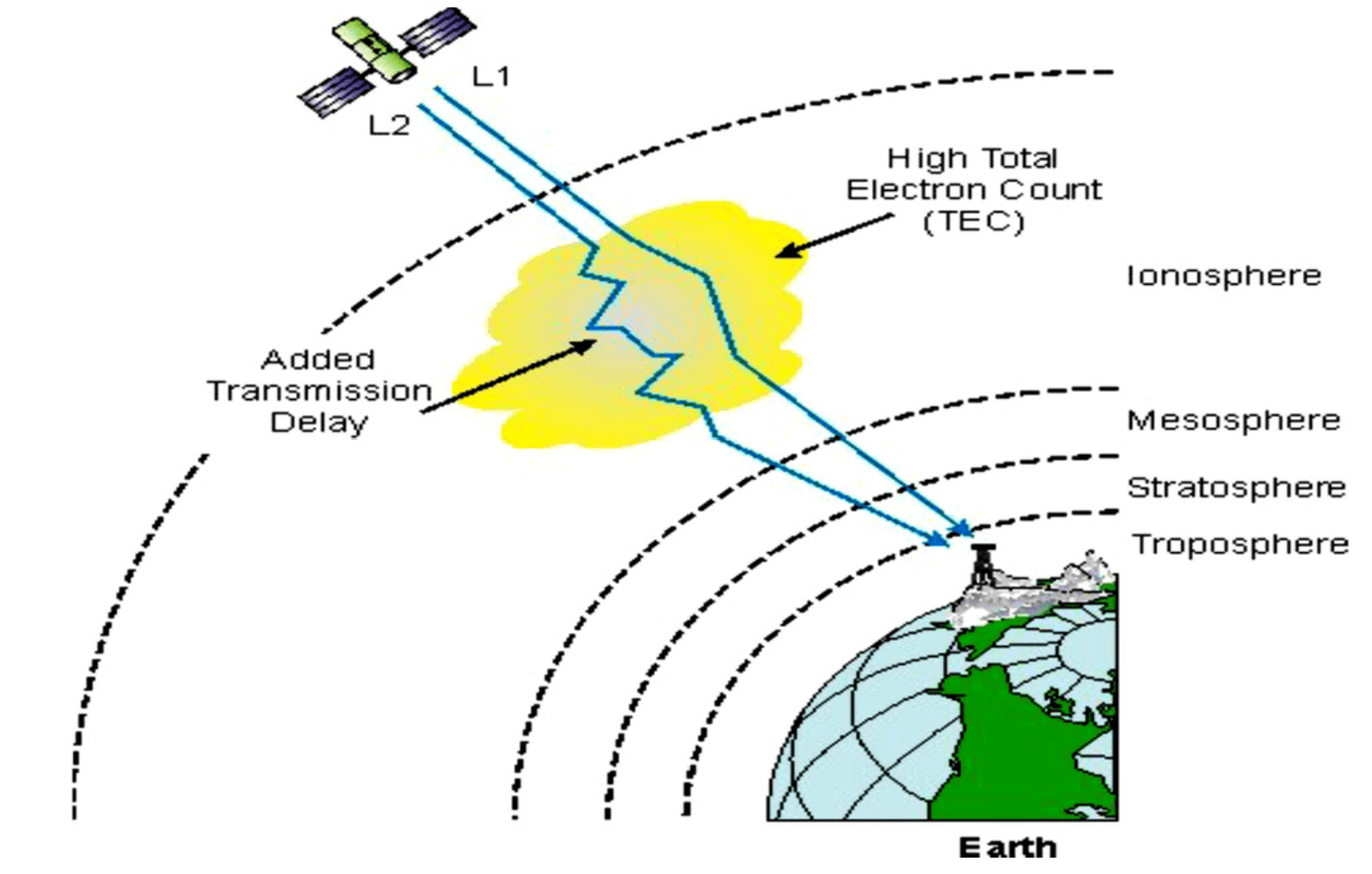
Image: The ionosphere delays the arrival of GPS signals and needs to be constantly measured and accounted for. Credit: Abba Et al.
The ionosphere is highly variable, affected by solar activities, day and night cycles, and just general motion of the atmosphere itself. During a tsunami a huge area of the ocean’s surface rises and falls in a single motion, which pushes a substantial amount of air above it. These ripples in the atmosphere rise all the way to space where they cause ripples in the ionosphere, which can then be detected by global navigation devices.
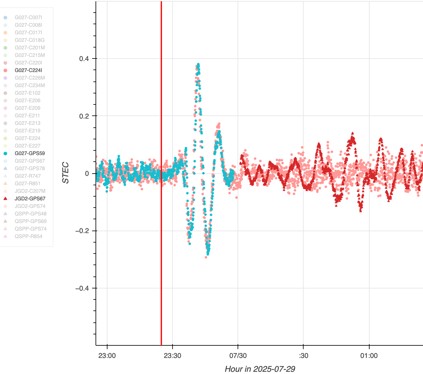
Image: Global navigation devices detected ripples in the ionosphere produced by the Kamchatka earthquake. Credit: NASA/JPL-Caltech
This is where NASA’s GUARDIAN technology enters the story. Like all NASA projects, it’s a tortured acronym. GUARDIAN stands for GNSS Upper Atmospheric Real-time Disaster Information and Alert Network. GNSS stands for Global Navigation Satellite System, of which GPS is an example.

Image: Did you get any of that?
On July 29 researchers had just installed an automated system for GUARDIAN to constantly observe data about the ionosphere and send notifications to scientists when something interesting happened, and the very next day it detected ripples in the ionosphere caused by the Kamchatka earthquake less than 20 minutes after it occurred, allowing a 40 minute warning time before the tsunami reached populated areas of the Pacific.
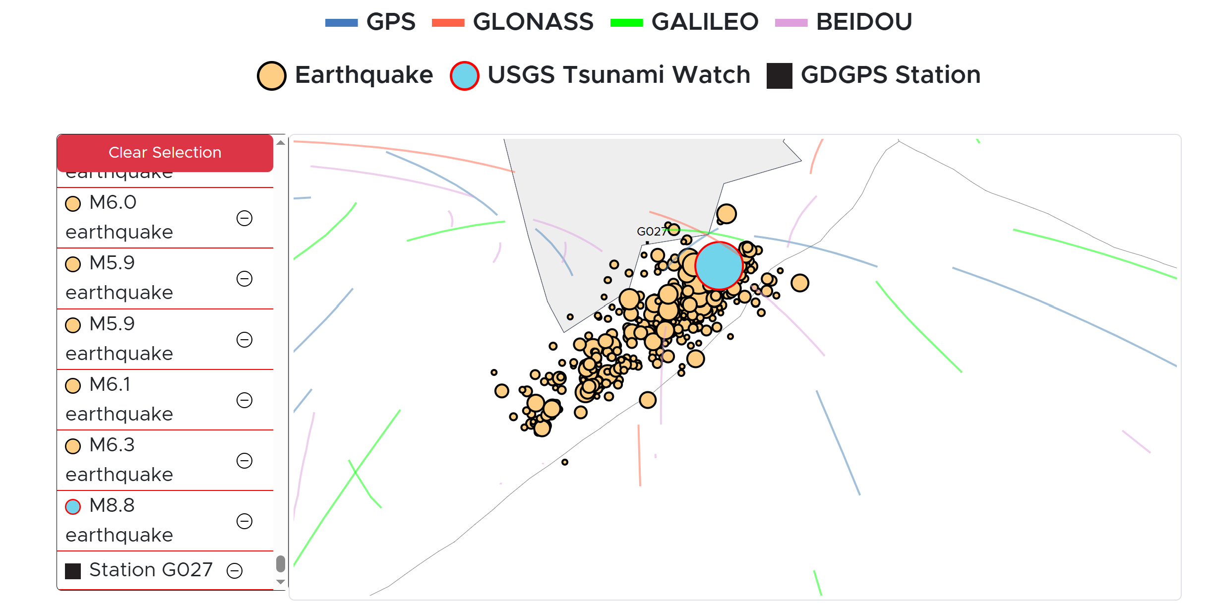
Image: Distortion of GNSS signals caused by the variable ionosphere, shown as streaks in the image, allowed the early detection of the Kamchatka tsunami. Credit: NASA/JPL-Caltech
Meanwhile, the US-French SWOT (Surface Water and Ocean Topography) satellite happened to pass overhead while the tsunami was travelling. Amongst other things, SWOT measures the height of the surface of the ocean relative to its average and clearly detected the presence of the tsunami, giving valuable validation and feedback to oceanographic models of these waves.
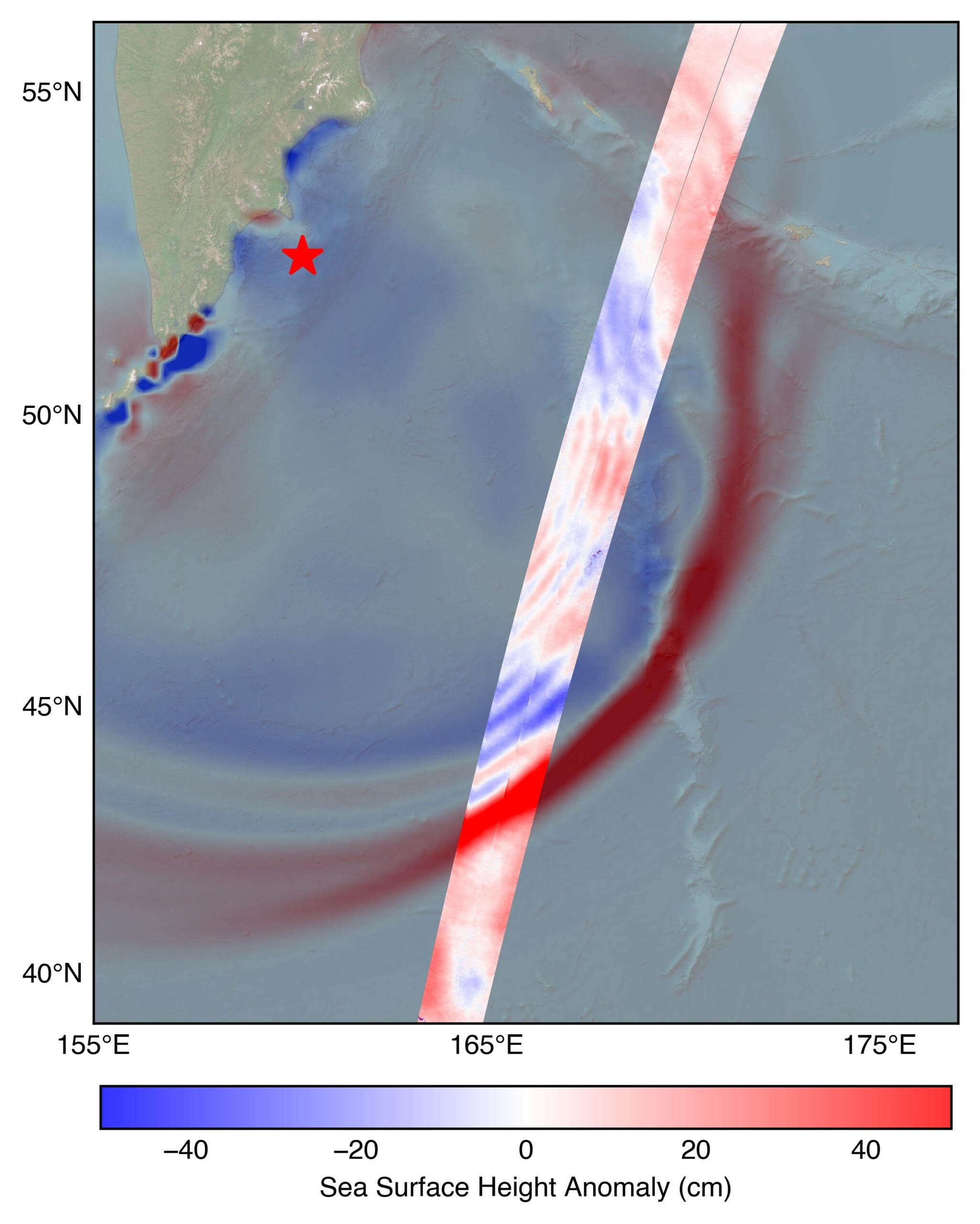
Image: SWOT measurements, shown as the bright streak, compared to mathematical model estimations, shaded. Red star shows the location of the quake. Credit: NASA/JPL-Caltech
This incredible case study shows how space technology has applications much closer to the ground than you might think.
Scitech is a not-for-profit organisation proudly supported by the Western Australian Government through the Department of Energy and Economic Diversification

Upon clicking the "Book Now" or "Buy Gift Card" buttons a new window will open prompting contact information and payment details.